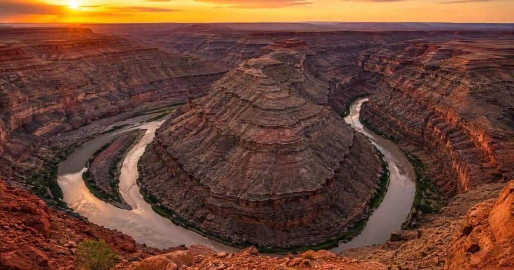
Most visitors expect Goosenecks State Park Utah to look like a scaled-down Horseshoe Bend and then they walk to the rim and realize the San Juan River bends not once but three times in the same view. The river drops 1,000 feet below the overlook and travels six miles to advance just 1.5 miles west, carving through 300 million years of exposed rock layers. There’s no trail, no fence beyond a low rail and almost no crowd, even on a Saturday in April. This guide covers what you’ll actually see, what to bring since the park has zero water on site and how it compares to nearby stops like Monument Valley and Valley of the Gods.
IN THIS GUIDE YOU WILL FIND:
- The exact entry and camping fees for Goosenecks State Park Utah in 2026
- Why the river takes six miles to move 1.5 miles west
- What camping is really like with no water, no shade and no reservations
- The unmarked route locals use to reach the river itself
- How far Monument Valley and Mexican Hat actually are
- The best months to avoid 100°F afternoons on the rim
QUICK INFO
Location | US Highway 163, southeastern Utah, 4 miles off the main road near Mexican Hat Nearest Airport | Cortez Municipal Airport, about 1.5 hours away Salt Lake City International, about 6 hours away Best Time to Visit | March to May and September to October, when daytime temperatures stay near 70°F Travel Time from Nearest Major City | About 6 hours from Salt Lake City, 4 hours from Phoenix Days Recommended | A few hours or one night if you camp Average Daily Cost | $5 to $25 per person, since there’s no lodging or food service inside the park
What Makes Goosenecks State Park Utah Worth the Detour
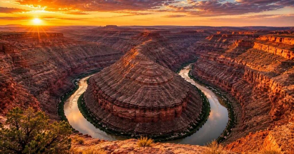
Goosenecks State Park Utah sits at 4,500 feet elevation on the edge of a canyon carved by the San Juan River. Geologists call this shape an entrenched meander and it formed as the river cut straight down through rising rock instead of spreading sideways like most rivers do. From the main overlook you can trace three distinct bends of the river in a single 180-degree view, something Horseshoe Bend near Page can’t match with its single curve. The exposed canyon walls reveal roughly 300 million years of geological layers, visible in bands of red, tan and gray rock.
The moment you arrive, you’ll notice there’s no visitor center, no gift shop and no paved trail system. A short gravel path leads from the parking area to the rim and the whole walk takes under five minutes each way. Most tourists don’t realize the park has no official trail down to the river; the unmarked Honaker Trail nearby is the only rugged route to the water and it requires real hiking experience. The park stays open 24 hours year-round, which makes it one of the few places in Utah where a 2 a.m. star session requires no permit or reservation.
Pro Tip: Walk 50 to 100 yards along the rim in either direction from the main parking area for a slightly different angle on the same three bends, since most visitors only see the view from directly in front of their car.
Fees, Camping and What You Need to Bring at Goosenecks State Park Utah
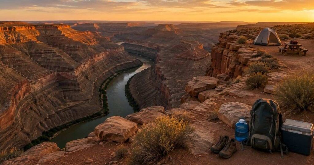
Day-use entry to Goosenecks State Park Utah costs $5 per vehicle and seniors 65 and older pay $2 per vehicle. The Utah State Parks annual pass covers entry here too, which pays for itself after about five visits to any state park in Utah. Camping costs $10 per night at one of the primitive rim-side sites, paid at a self-serve fee kiosk when no ranger is present. There are no reservations, so sites go first-come, first-served and arriving by early afternoon gives you the best chance at a spot with a picnic table.
There is no drinking water anywhere in the park, so bring at least one gallon per person per day, more if you’re camping overnight. Vault toilets are the only facility besides a handful of covered picnic tables near the entrance, there’s no shade beyond those tables and no dump station for RVs. Cell service is unreliable this far from Mexican Hat, so download offline maps before you arrive. Wind picks up most afternoons, so stake tents well back from the canyon edge rather than camping right on the rim.
Pro Tip: Skip the sites directly on the cliff edge if you’re traveling with kids, since the drop is unfenced and several campground reviews flag it as a real safety concern.
Best Time to Visit and What’s Nearby
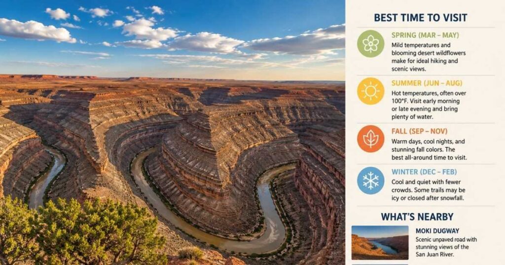
March through May and September through October bring daytime highs near 70°F, which makes rim walks and camping comfortable without the summer heat. Summer temperatures regularly exceed 100°F with zero shade at the overlook, so plan a sunrise or sunset visit to Goosenecks State Park Utah instead of a midday stop between June and August. Winter brings occasional snow and ice on the access road and nighttime temperatures can drop below freezing, though clear winter skies make for excellent stargazing. Goosenecks State Park Utah earned International Dark Sky Park certification in March 2021 and the remote location means the Milky Way is visible with the naked eye on clear, moonless nights.
Mexican Hat sits just 8 miles east of Goosenecks State Park Utah, with the San Juan Cafe serving burgers and Navajo fry bread for around $10 to $15 a plate. Monument Valley Navajo Tribal Park is roughly 40 minutes southeast, where sandstone buttes rise 400 to 1,000 feet above the valley floor. Valley of the Gods, a scenic dirt-road loop with similar red rock formations, sits about 20 minutes northeast and charges no entry fee at all. Bluff, the nearest town with hotels and full services, is 25 miles east along US 163.
Verdict: Pair a sunset stop at Goosenecks with a Monument Valley visit the same day, since the two sites sit less than an hour apart and show completely different rock formations.
Getting to Goosenecks State Park Utah and Avoiding Common Mistakes
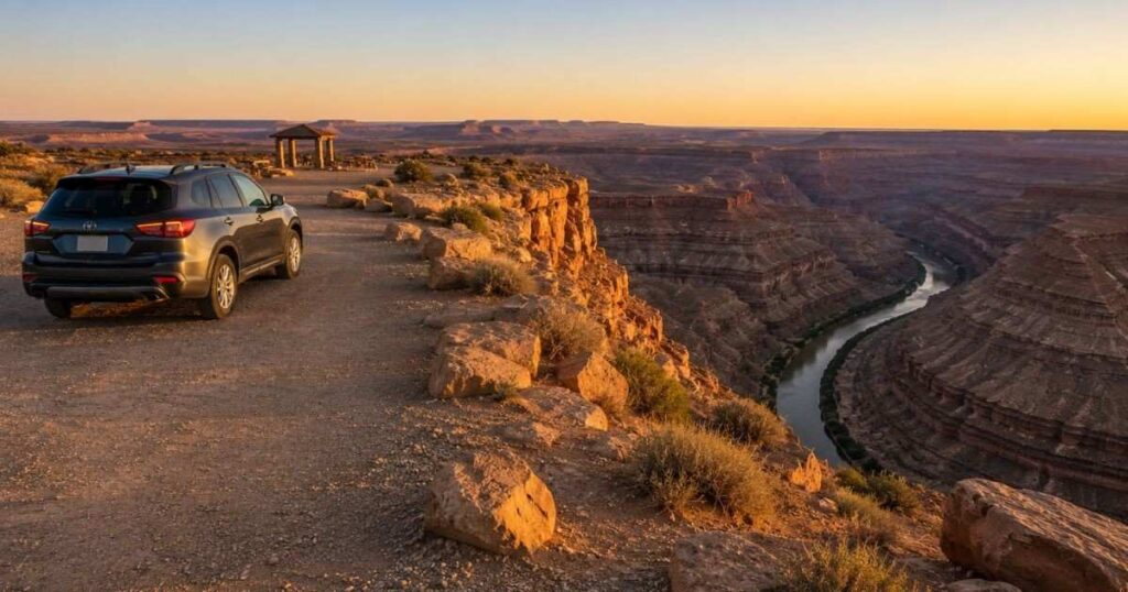
Goosenecks State Park Utah sits 4 miles north of US Highway 163 on Utah Route 316, a paved road suitable for any vehicle. The turnoff is well-marked but easy to miss if you’re driving fast between Mexican Hat and Natural Bridges National Monument. GPS apps sometimes route visitors onto rougher dirt roads near the park stick to Route 316 from the highway rather than any shortcut a map suggests. The drive from Salt Lake City covers about 349 miles and takes close to 6 hours, so most visitors combine it with a longer Utah canyon country road trip rather than a standalone day trip.
The biggest mistake first-time visitors to Goosenecks State Park Utah make is treating this as a quick 10-minute photo stop and missing the side views along the rim. Another common error is arriving at midday in summer, when the flat light washes out the canyon’s color and the heat makes even a short walk uncomfortable. Pets are allowed on a leash but there’s no shade for them either, so bring extra water if you’re traveling with a dog. Drones are popular here for capturing the full S-curve of the river, though check current park rules before flying, since restrictions can change.
Pro Tip: Arrive 30 minutes before sunset in spring or fall, when low-angle light turns the exposed rock layers a deeper red than midday sun ever shows.
“Planning more Arizona day trips? Our guides on bell rock trail, Cathedral Rock Sedona, montezuma castle arizona , flagstaff to grand canyon, phoenix to grand canyon, north rim grand canyon and upper vs lower antelope canyon cover the rest of the region in detail.”
Frequently Asked Questions
How many days do you need at Goosenecks State Park Utah?
A few hours cover the main overlook and a short rim walk, since there are no maintained trails and the park itself is small. Stay one night if you want stargazing, since the Dark Sky certification means the sky here rivals any observatory-grade viewing spot in the Southwest. Most travelers fold Goosenecks into a longer loop through Monument Valley, Valley of the Gods and Mexican Hat rather than visiting it alone.
Is Goosenecks State Park Utah worth visiting in 2026?
Yes, the $5 entry fee buys a view of three river bends that most national parks charge $35 or more to see. You will find far smaller crowds here than at Horseshoe Bend or Monument Valley, since Goosenecks sits off the main tourist circuit despite being just as dramatic. The 2021 Dark Sky Park certification adds a nighttime reason to visit beyond the daytime overlook.
What is the best time to visit Goosenecks State Park Utah?
Spring and fall, specifically March through May and September through October, offer the mildest temperatures for both the overlook and overnight camping. Summer exceeds 100°F with no shade anywhere in the park, making midday visits genuinely uncomfortable. Winter brings clear, cold nights that are excellent for stargazing, though the access road can ice over after storms.
Is Goosenecks State Park Utah expensive for tourists?
No, it’s one of the cheapest stops in southeastern Utah, with day-use entry at $5 per vehicle and camping at $10 per night. There’s no food, water or fuel sold inside the park, so your only other costs come from gas and meals in Mexican Hat or Bluff. A full day here, including a meal at the San Juan Cafe, typically runs under $25 per person.
Can you do a day trip from Monument Valley to Goosenecks State Park Utah?
Yes, the drive takes about 40 minutes each way along US 163 and Route 316, making it an easy add-on to a Monument Valley visit. Many visitors stop at Goosenecks in the late afternoon after touring Monument Valley’s Scenic Drive, then continue on to Mexican Hat or Bluff for the night. The short distance means you can see both in a single afternoon without rushing either stop.
Final Thoughts
Goosenecks State Park Utah proves that a five-dollar entry fee can still deliver a view most people drive hundreds of miles to see. The three visible river bends, the exposed 300-million-year-old rock layers and the near-total absence of crowds make this one of the best value stops in the entire Four Corners region. Bring your own water, arrive 30 minutes before sunset and walk the full length of the rim instead of stopping at the first viewpoint you reach. Stay past dark if you can, since the same canyon that glows red at sunset turns into one of the clearest star fields in southern Utah once the sky goes black. Category: Destinations