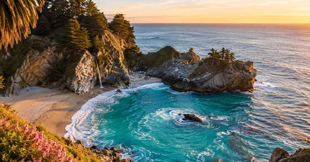
The water at McWay Falls Big Sur does not crash into a churning surf. It drops 80 feet from a granite cliff and lands on a sandy cove so still it looks painted on. Most first-time visitors expect a roaring waterfall and instead find something closer to a quiet postcard. That contradiction is exactly why McWay Falls Big Sur has become one of the most photographed stops on the entire Pacific Coast Highway.
This guide covers what changed at the site in 2025, how to see the falls right now and what else sits nearby along Big Sur.
IN THIS GUIDE YOU WILL FIND:
- Why the main Overlook Trail at McWay Falls Big Sur has been closed since April 2025
- The exact viewing spot to use while the trail stays shut
- What the $10 entry fee at Julia Pfeiffer Burns State Park actually covers
- Which nearby trail is still open and worth the detour
- The best months to avoid morning fog at McWay Cove
- How McWay Falls compares to Alamere Falls, California’s other coastal tidefall
| Quick Info | Details |
| Location | Julia Pfeiffer Burns State Park, Highway 1, Big Sur, CA |
| Nearest Airport | Monterey Regional Airport (MRY), 60 miles / about 90 minutes |
| Best Time to Visit | April, May, September, October (mild weather, less fog) |
| Travel Time from Nearest City | 55–75 minutes south of Carmel-by-the-Sea |
| Days Recommended | Half day (pair with other Big Sur stops) |
| Average Daily Cost | $10 park entry + $15–$40 for lunch and gas |
McWay Falls Big Sur: What You’re Actually Looking At
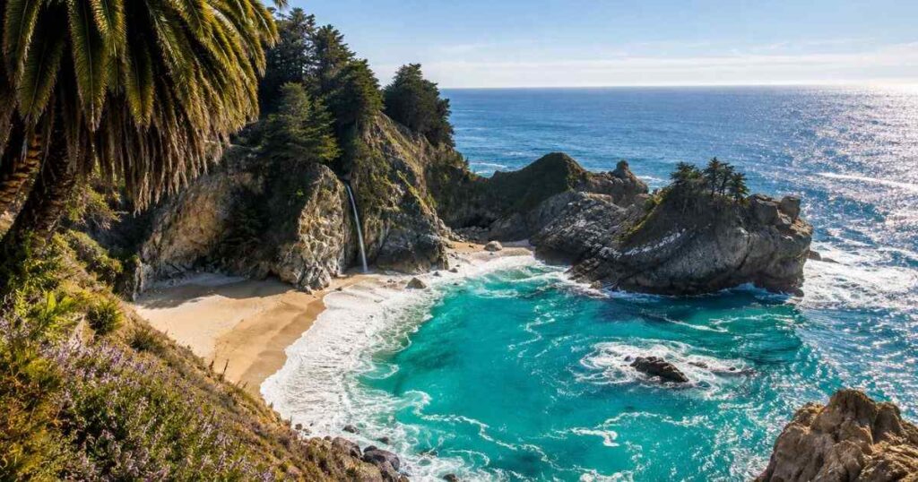
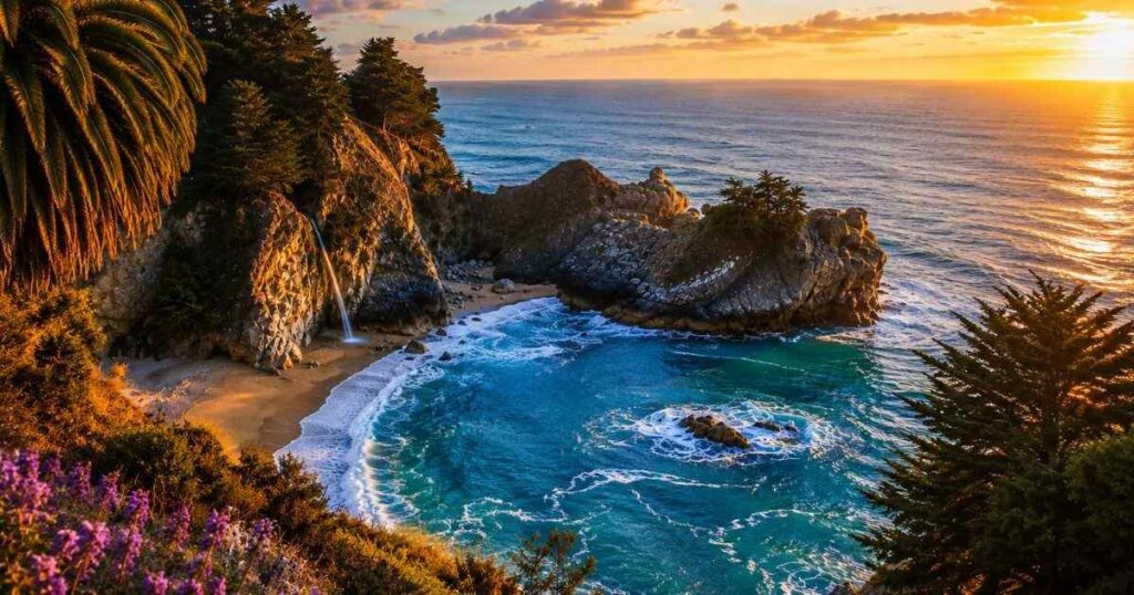
McWay Falls Big Sur sits inside Julia Pfeiffer Burns State Park, about 37 miles south of Carmel-by-the-Sea on Highway 1. McWay Creek drops 80 feet over a cliff edge directly into the Pacific Ocean or onto the beach below, depending on the tide. This makes it a tidefall, a rare waterfall type with only two examples in California. The beach itself sits inside a cove carved into the cliff, ringed by cypress trees and often streaked with turquoise water.
You cannot walk down to that beach. California State Parks blocks all access to the cove and the surrounding cliffs and rangers cite violators. The water color shifts through the day as sediment moves with the tide.
A photo taken at 9 a.m. often looks nothing like one taken at 4 p.m. Most visitors don’t realize the waterfall actually thins out by late summer, since McWay Creek relies on winter rainfall for its flow.
Pro Tip: Visit within two hours of sunset for the richest turquoise water color at McWay Cove, since low afternoon light cuts glare off the surface.
Julia Pfeiffer Burns State Park: Fees, Hours and the 2025 Trail Closure
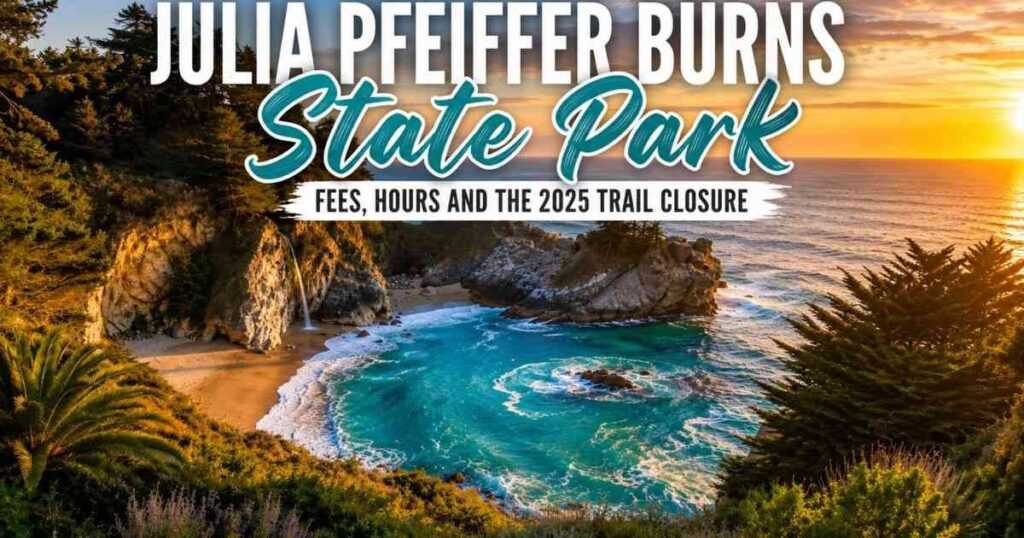
Entry to Julia Pfeiffer Burns State Park costs $10 per car, paid at a self-service kiosk when no attendant is on duty. The park opens at 8 a.m. and closes at sunset and that single fee also covers same-day entry to other California state parks. Here’s the part that catches people off guard: the short Overlook Trail that leads directly to the waterfall viewpoint has been closed since April 16, 2025, for a retaining wall repair project that state parks staff expect to continue through 2026.
During the closure, the only official view of the waterfall comes from a small pullout on Highway 1 itself, just north of the park entrance. It’s a fast stop, not a hike and parking there fills up by mid-morning on weekends. The Ewoldsen Trail inside the same park stays open and is worth the detour on its own. It runs about 4.5 miles round trip through redwood groves and climbs roughly 1,600 feet, rewarding hikers with canyon views instead of a cliffside waterfall.
Verdict: Budget 20 minutes for the Highway 1 pullout view of McWay Falls Big Sur or half a day if you add the Ewoldsen Trail while you’re at the park.
What Else to Do Near McWay Falls Big Sur
McWay Falls Big Sur sits 12 miles south of Pfeiffer Big Sur State Park and 14 miles north of Limekiln State Park, which makes it an easy midpoint stop on a longer Highway 1 drive. Partington Cove, roughly 2 miles north, has a short unmarked trail through a tunnel that leads to a rocky inlet once used to load tan-oak bark onto ships. Nepenthe restaurant, about 11 miles north, serves lunch on a cliffside deck with ocean views and entrees running $22 to $38.
Pfeiffer Beach, with its purple-streaked sand, sits roughly 15 miles north and charges a separate $12 vehicle fee. If you’re driving from Monterey or Carmel for the day, plan this stop for midday, since fog often blankets the coastline until 10 or 11 a.m. from late spring through summer. Bixby Bridge, the most photographed bridge on Highway 1, sits about 25 miles north and adds only a five-minute detour.
Deetjen’s Big Sur Inn, a rustic 1930s restaurant about 13 miles north, serves breakfast for $14 to $22 in a redwood-shaded dining room that predates the highway itself. Andrew Molera State Park, 18 miles north, offers free parking and a flatter, easier coastal trail if the Ewoldsen Trail feels too steep for your group. Most people underestimate how much daylight this stretch of coast eats up, since single-lane sections and scenic pullouts slow a 25-mile drive to well over an hour.
Pro Tip: Stop at Nepenthe on the way south and the falls on the way back north, since the pullout parking clears out noticeably after 2 p.m.
Practical Tips for Visiting McWay Falls Big Sur
Cell service disappears for long stretches of Highway 1 near the site, so download offline maps before you leave Carmel or Monterey. The road has no shoulder in many sections and pulling over anywhere except marked turnouts is both dangerous and illegal. Gas stations are scarce south of the Big Sur River Inn, so fill up before you head south. Bring cash, since the park’s self-service fee kiosk does not process cards when no attendant is present.
Layer your clothing regardless of season. Coastal temperatures near the falls typically run 55°F to 68°F even in July and wind off the Pacific cuts through light jackets fast. Weekend parking at the Highway 1 pullout fills by 10 a.m. from June through August.
Arrive before 9 a.m. or after 4 p.m. if you’re visiting on a Saturday or Sunday. Avoid planning a full day around this one stop, since the current viewing setup takes only 15 to 20 minutes.
Restrooms at the pullout are limited to a single vault toilet, so use facilities in Big Sur Village beforehand if you can. Motion sickness hits many first-time passengers on this road, since Highway 1 curves constantly for miles at a time. Sitting in the front seat and keeping eyes on the horizon helps more than any medication.
Pro Tip: Screenshot the Highway 1 pullout location on Google Maps before you lose signal, since it isn’t well marked from the road.
Frequently Asked Questions
How many days do you need for McWay Falls Big Sur?
You need about 20 minutes at the site itself, since the Overlook Trail closure limits access to a quick roadside view. Most visitors fold McWay Falls Big Sur into a single day trip alongside Bixby Bridge, Nepenthe and Pfeiffer Beach. Plan a half day if you also want to hike the Ewoldsen Trail inside the same park.
Is McWay Falls Big Sur worth visiting despite the trail closure?
Yes, the Highway 1 pullout still delivers a clear view of the 80-foot tidefall and the turquoise cove below. The closure removes the close-up cliffside angle, not the waterfall itself. Most people who stop still call it one of the best five minutes on the entire Pacific Coast Highway.
What is the best time to visit McWay Falls Big Sur?
April, May, September and October bring the clearest skies and the least morning fog along this stretch of Big Sur. Arrive between 2 and 4 p.m. for the strongest turquoise color in McWay Cove. Summer mornings often stay foggy until 10 or 11 a.m., which flattens photos.
Is McWay Falls Big Sur expensive for tourists?
No, entry to Julia Pfeiffer Burns State Park costs $10 per car and the viewpoint itself is free once you’re inside. Add $15 to $40 for lunch nearby at spots like Nepenthe or the Big Sur Bakery. A full day covering this stop plus two or three other Big Sur stops typically runs $40 to $70 per person including gas and food.
Can you do a day trip from Monterey to McWay Falls Big Sur?
Yes, the site sits about 60 miles south of Monterey, a drive of roughly 90 minutes each way on Highway 1. Most travelers combine it with Carmel-by-the-Sea, Bixby Bridge and Nepenthe to fill a full day. Leaving Monterey by 9 a.m. gives enough time to reach McWay Falls Big Sur before afternoon crowds build at the pullout.
Final Thoughts
McWay Falls Big Sur remains one of the few places on Highway 1 where a waterfall, a hidden beach and the open Pacific sit inside a single frame. The current Overlook Trail closure changes how you see it, not whether it’s worth the stop. Pull off at the McWay Falls Big Sur viewpoint north of the park entrance, wait for a break in passing cars and watch the color of McWay Cove shift as clouds move overhead. Give it ten unhurried minutes before you get back on the road.